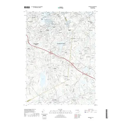
2018 Map of Weymouth
USGS Topo · Published 2018About this map
Weymouth Fore River Marshes and the complex tidal inlets of the Atlantic Ocean define the northern coastline of this South Shore study, illustrating the dense residential and industrial layout of the late 2010s. The landscape is a mix of established neighborhoods and specialized districts, such as the Libbey Industrial Pkwy corridor and the sprawling grounds of Weymouth Town. Genealogy and local history are exceptionally well-represented through numerous burial sites, ranging from the historic Old North Cem and North Weymouth Cem to specific family plots like the Gould Family Burying Ground Cem and the Hunt Family Tomb Site. From the heights of King Oak Hill to the shores of Whitmans Pond, the map details a mature urban-suburban geography shaped by centuries of Massachusetts maritime and inland development.
Find a feature on this map
115 named features on this map. Tap any name to fly to it.
Don’t see what you’re looking for? This feature index may not catch every label — zoom into the map to look around manually.
Map Details
Editions of this 2018 Weymouth Map
This is the sole edition of this map. No revisions or reprints were ever made.
Other maps of this area

1885 · Abington
USGS Topo · 1:62,500

1886 · Dedham
USGS Topo · 1:62,500

1888 · Abington
USGS Topo · 1:62,500

1892 · Boston Bay
USGS Topo · 1:62,500

1893 · Abington
USGS Topo · 1:62,500

1893 · Boston
USGS Topo · 1:62,500

1894 · Dedham
USGS Topo · 1:62,500

1903 · Boston
USGS Topo · 1:62,500

1903 · Boston Bay
USGS Topo · 1:62,500

1919 · Dedham
USGS Topo · 1:62,500