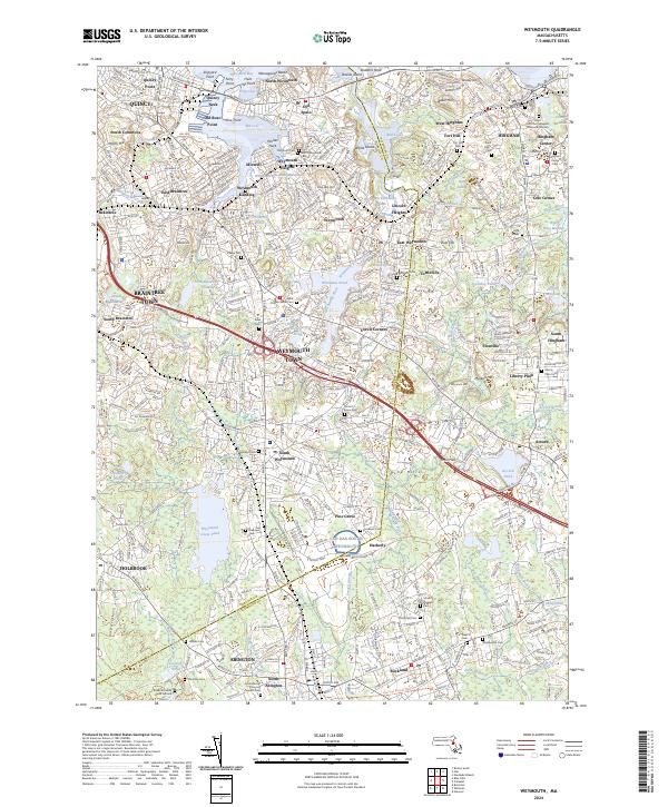
2024 Map of Weymouth
USGS Topo · Published 2024About this map
Weymouth Back River and its intricate marshes define the coastal transition between North Weymouth and Hingham. This suburban landscape is heavily marked by its municipal history, particularly through its numerous cemeteries and burying grounds that serve as a genealogical record for families in Norfolk County and Plymouth County. From the Gould Family Burying Ground Cem to the Hingham Center Cem, these sites anchor the long-standing residential developments that have grown around historical hubs like Weymouth Landing and Old Spain.
Find a feature on this map
125 named features on this map. Tap any name to fly to it.
Don’t see what you’re looking for? This feature index may not catch every label — zoom into the map to look around manually.
Map Details
Editions of this 2024 Weymouth Map
This is the sole edition of this map. No revisions or reprints were ever made.
Other maps of this area

1885 · Abington
USGS Topo · 1:62,500

1886 · Dedham
USGS Topo · 1:62,500

1888 · Abington
USGS Topo · 1:62,500

1892 · Boston Bay
USGS Topo · 1:62,500

1893 · Abington
USGS Topo · 1:62,500

1893 · Boston
USGS Topo · 1:62,500

1894 · Dedham
USGS Topo · 1:62,500

1903 · Boston
USGS Topo · 1:62,500

1903 · Boston Bay
USGS Topo · 1:62,500

1919 · Dedham
USGS Topo · 1:62,500