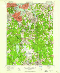
1947 Map of Weymouth
USGS Topo · Published 1958About this map
The New York New Haven and Hartford RR corridor defines the industrial and residential spine of this mid-century coastal landscape, connecting East Braintree and South Weymouth. This survey illustrates a period of significant post-war transition, where traditional New England town centers like Weymouth and Hingham sit alongside the expansive U S Naval Reservation. The map captures the working landscape of the era, from the heavy industry of the Plymouth Quarries and Miller Quarries to the civic foundations at the Civic Center and Town Hall.
Find a feature on this map
104 named features on this map. Tap any name to fly to it.
Don’t see what you’re looking for? This feature index may not catch every label — zoom into the map to look around manually.
Map Details
Editions of this 1947 Weymouth Map
This is the sole edition of this map. No revisions or reprints were ever made.
Other maps of this area

1885 · Abington
USGS Topo · 1:62,500

1886 · Dedham
USGS Topo · 1:62,500

1888 · Abington
USGS Topo · 1:62,500

1892 · Boston Bay
USGS Topo · 1:62,500

1893 · Abington
USGS Topo · 1:62,500

1893 · Boston
USGS Topo · 1:62,500

1894 · Dedham
USGS Topo · 1:62,500

1903 · Boston
USGS Topo · 1:62,500

1903 · Boston Bay
USGS Topo · 1:62,500

1919 · Dedham
USGS Topo · 1:62,500