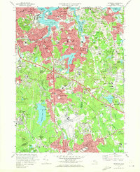
1971 Map of Weymouth
USGS Topo · Published 1973About this map
South Weymouth Naval Air Station anchors the southern portion of this coastal Norfolk County landscape, illustrating the significant military presence in the region during the early 1970s. The map captures the dense suburban development of Quincy and Weymouth, where tight residential grids meet the complex shoreline of Town River Bay and the Fore River. Industrial and maritime features are prominent, including the drydocks and powerplant near Quincy Point, and several active quarries and gravel pits that underscore the area's geological utility. Inland, the landscape is punctuated by numerous schools like Notre Dame Academy and South High Sch, alongside spiritual and historic sites such as Old North Cem and St Francis Xavier Cem. The Penn Central rail lines and various state routes weave through established neighborhoods like East Braintree and Lovell Corners, connecting the industrial waterfront to the interior woodlands and reservoirs.
Find a feature on this map
138 named features on this map. Tap any name to fly to it.
Don’t see what you’re looking for? This feature index may not catch every label — zoom into the map to look around manually.
Map Details
Editions of this 1971 Weymouth Map
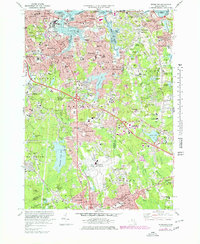
2 editions found
Other maps of this area

1885 · Abington
USGS Topo · 1:62,500

1886 · Dedham
USGS Topo · 1:62,500

1888 · Abington
USGS Topo · 1:62,500

1892 · Boston Bay
USGS Topo · 1:62,500

1893 · Abington
USGS Topo · 1:62,500

1893 · Boston
USGS Topo · 1:62,500

1894 · Dedham
USGS Topo · 1:62,500

1903 · Boston
USGS Topo · 1:62,500

1903 · Boston Bay
USGS Topo · 1:62,500

1919 · Dedham
USGS Topo · 1:62,500