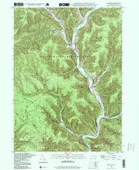
1994 Map of Wharton
USGS Topo · Published 1999About this map
First Fork Sinnemahoning Creek carves a deep valley through this timbered landscape, which is dominated by the Susquehanna State Forest and Elk State Forest. The settlement of Wharton sits at the confluence with the East Fork Sinnemahoning Cr, while the village of Costello occupies the junction of Freeman Run and the First Fork. The terrain is marked by numerous steep hollows like Big Canyon Hol and Fish Basket Hol, reflecting the area's history as a rugged forestry and extraction region. Evidence of early industry remains in the presence of a Splash Dam and a Gas Well, alongside several local landmarks like the Reesville Sch and St Josephs Cem. To the south, Sinnemahoning State Park preserves the natural character of the river valley near the Potter and Cameron county line.
Find a feature on this map
61 named features on this map. Tap any name to fly to it.
Don’t see what you’re looking for? This feature index may not catch every label — zoom into the map to look around manually.
Map Details
Editions of this 1994 Wharton Map
This is the sole edition of this map. No revisions or reprints were ever made.
Other maps of this area

1945 · Driftwood
USGS Topo · 1:48,000

1945 · First Fork
USGS Topo · 1:24,000

1945 · Cameron
USGS Topo · 1:24,000

1946 · Renovo West
USGS Topo · 1:62,500

1946 · Hammersley Fork
USGS Topo · 1:24,000

1947 · Cameron
USGS Topo · 1:24,000

1947 · First Fork
USGS Topo · 1:24,000

1947 · Conrad
USGS Topo · 1:62,500

1947 · Conrad
USGS Topo · 1:24,000

1947 · Ayers Hill
USGS Topo · 1:24,000