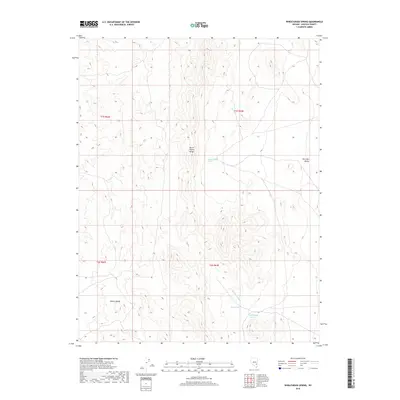
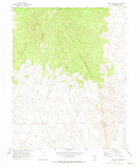
2018 Map of Wheatgrass Spring
USGS Topo · Published 2018About this map
The North Pahroc Range and the Pahroc Range dominate this high-desert landscape in Lincoln County, Nevada, where water sources dictated the movement of both people and livestock. Topography is defined by the steep slopes and ridges of these ranges, falling away into the broad expanse of Dry Lake Valley to the east. Critical water points like Wheatgrass Spring, Pace Spring, and Rattlesnake Spring are the primary landmarks in this arid environment, connected by the seasonal drainage of Wheatgrass Wash. This 2018 survey serves as a modern record of the public land survey system, illustrating the township and range grid (including t1s r63e and t2s r63e) as it overlays a terrain that remains largely undeveloped and defined by its natural hydrology.
Find a feature on this map
11 named features on this map. Tap any name to fly to it.
Don’t see what you’re looking for? This feature index may not catch every label — zoom into the map to look around manually.
Map Details
Editions of this 2018 Wheatgrass Spring Map
This is the sole edition of this map. No revisions or reprints were ever made.
Other maps of this area

1885 · Pioche
USGS Topo · 1:250,000

1886 · Pioche
USGS Topo · 1:250,000

1954 · Caliente
USGS Topo · 1:250,000

1959 · Caliente
USGS Topo · 1:250,000

1970 · Hiko NE
USGS Topo · 1:24,000
1970 · Deadman Spring
USGS Topo · 1:24,000
1970 · Deadman Spring SE
USGS Topo · 1:24,000

1970 · Wheatgrass Spring
USGS Topo · 1:24,000
1970 · Deadman Spring NE
USGS Topo · 1:24,000
1970 · Weepah Spring
USGS Topo · 1:24,000