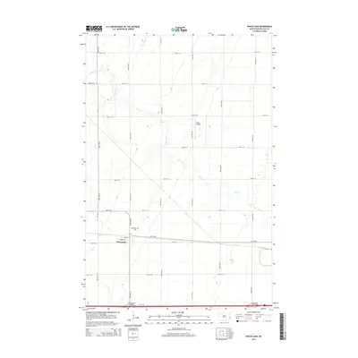
2014 Map of Wheatland
USGS Topo · Published 2014About this map
Wheatland serves as the focal point of this agricultural landscape in Cass County, where the grid of the Red River Valley is bisected by the meandering course of Swan Creek. The settlement is neatly arranged along Front Street and Brown Street, reflecting the town's origins as a rail-adjacent prairie community. To the northwest of the main cluster of homes lies the Wheatland Cemetery, a vital site for genealogical research in the region. The map captures the infrastructure of the early 21st century, showing the transition from local gravel roads like 150th Ave SE to modern transport hubs such as the Wheatland-Chaffee Interchange and the Lynchburg Interchange. Aviation is represented by the Vining Airport, a small private airstrip situated among the sections north of the town center.
Find a feature on this map
24 named features on this map. Tap any name to fly to it.
Don’t see what you’re looking for? This feature index may not catch every label — zoom into the map to look around manually.
Map Details
Editions of this 2014 Wheatland Map
This is the sole edition of this map. No revisions or reprints were ever made.
Other maps of this area

1895 · Casselton
USGS Topo · 1:125,000

1897 · Casselton
USGS Topo · 1:125,000

1952 · Grand Forks
USGS Topo · 1:250,000

1953 · Fargo
USGS Topo · 1:250,000

1956 · Fargo
USGS Topo · 1:250,000

1956 · Grand Forks
USGS Topo · 1:250,000

1961 · Durbin
USGS Topo · 1:24,000

1961 · Casselton
USGS Topo · 1:24,000

1966 · Grand Forks
USGS Topo · 1:250,000
1967 · Wheatland
USGS Topo · 1:24,000