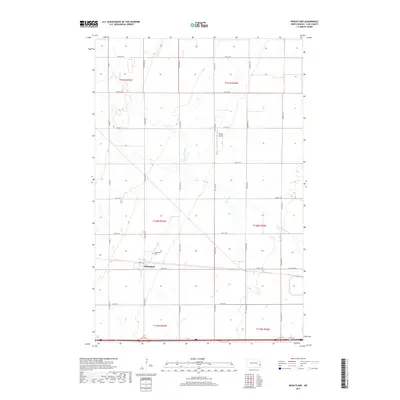
2017 Map of Wheatland
USGS Topo · Published 2017About this map
Wheatland serves as the primary hub of activity in this section of Cass County, where the grid of the North Dakota prairie meets the curve of Swan Creek. The town's layout is anchored by Front St and 35th St SE, reflecting the importance of transportation routes through the flat agricultural landscape. Just outside the main settlement, the Wheatland Cem stands as a focal point for local family history and genealogy. To the north, the Vining Airport and the meandering path of Swan Creek break the geometric regularity of the section lines. The map reveals a highly structured road network, including Old Co Rd 10 and numbered avenues from 148th Ave SE to 153rd Ave SE, which facilitate the movement of goods and people across this expansive farming region.
Find a feature on this map
29 named features on this map. Tap any name to fly to it.
Don’t see what you’re looking for? This feature index may not catch every label — zoom into the map to look around manually.
Map Details
Editions of this 2017 Wheatland Map
This is the sole edition of this map. No revisions or reprints were ever made.
Other maps of this area

1895 · Casselton
USGS Topo · 1:125,000

1897 · Casselton
USGS Topo · 1:125,000

1952 · Grand Forks
USGS Topo · 1:250,000

1953 · Fargo
USGS Topo · 1:250,000

1956 · Fargo
USGS Topo · 1:250,000

1956 · Grand Forks
USGS Topo · 1:250,000

1961 · Durbin
USGS Topo · 1:24,000

1961 · Casselton
USGS Topo · 1:24,000

1966 · Grand Forks
USGS Topo · 1:250,000
1967 · Wheatland
USGS Topo · 1:24,000