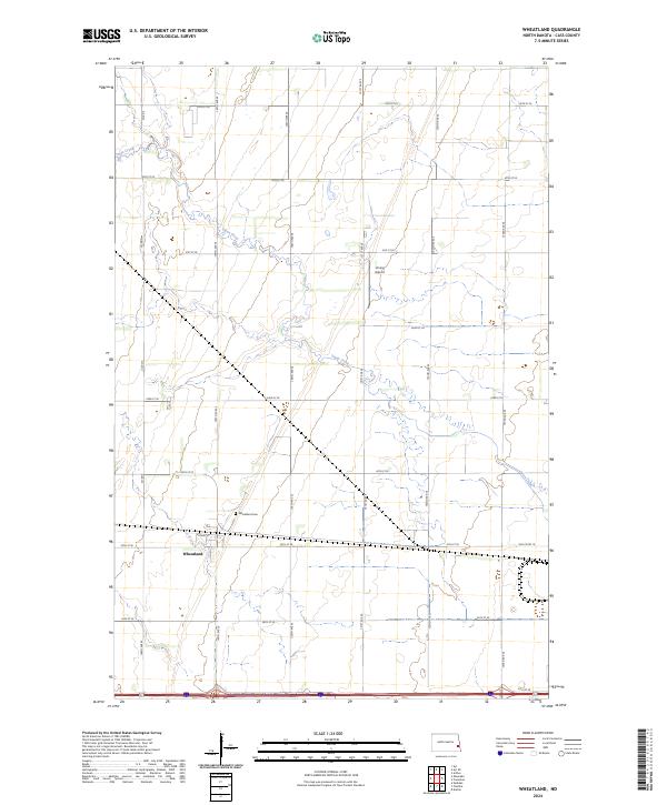
2024 Map of Wheatland
USGS Topo · Published 2024About this map
Wheatland serves as the primary hub of this eastern North Dakota landscape, organized by a precise grid of sectional roads and the curving path of Swan Creek. The settlement pattern is defined by the intersection of Front St and the regional thoroughfares of 149th Ave SE and 35th St SE. To the north of the town center, Wheatland Cem remains a significant site for local genealogical research, while the presence of Vining Airport to the northeast highlights the importance of general aviation in this rural agricultural corridor. The terrain is marked by the meandering drainage of Swan Creek, which cuts across the township lines of t140n r53w and t140n r52w, creating the only significant break in the otherwise uniform square-mile sections of Cass County.
Find a feature on this map
28 named features on this map. Tap any name to fly to it.
Don’t see what you’re looking for? This feature index may not catch every label — zoom into the map to look around manually.
Map Details
Editions of this 2024 Wheatland Map
This is the sole edition of this map. No revisions or reprints were ever made.
Other maps of this area

1895 · Casselton
USGS Topo · 1:125,000

1897 · Casselton
USGS Topo · 1:125,000

1952 · Grand Forks
USGS Topo · 1:250,000

1953 · Fargo
USGS Topo · 1:250,000

1956 · Fargo
USGS Topo · 1:250,000

1956 · Grand Forks
USGS Topo · 1:250,000

1961 · Durbin
USGS Topo · 1:24,000

1961 · Casselton
USGS Topo · 1:24,000

1966 · Grand Forks
USGS Topo · 1:250,000
1967 · Wheatland
USGS Topo · 1:24,000