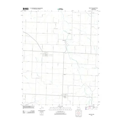
2012 Map of Wheaton
USGS Topo · Published 2012About this map
Shoal Creek meanders northward through this Barry County landscape, anchoring a series of small agricultural settlements and rural crossings. The town of Wheaton serves as the primary hub in the south, while the northern reaches of the map are dotted with established communities like Pioneer, Fairview, and the outlying Pulaskifield near the source of South Fork Capps Creek. The terrain is defined by its drainage patterns, with several named tributaries including Zerbert Branch, Middle Indian Creek, and Huffman Branch carving through the prairie-and-woodland mosaic.
Find a feature on this map
64 named features on this map. Tap any name to fly to it.
Don’t see what you’re looking for? This feature index may not catch every label — zoom into the map to look around manually.
Map Details
Editions of this 2012 Wheaton Map
This is the sole edition of this map. No revisions or reprints were ever made.
Other maps of this area

1937 · Cassville
USGS Topo · 1:48,000

1941 · Rocky Comfort
USGS Topo · 1:62,500

1943 · Ritchey
USGS Topo · 1:62,500

1943 · Monett
USGS Topo · 1:62,500

1943 · Rocky Comfort
USGS Topo · 1:62,500

1944 · Cassville
USGS Topo · 1:62,500

1945 · Harrison
USGS Topo · 1:250,000

1949 · Harrison
USGS Topo · 1:250,000

1954 · Harrison
USGS Topo · 1:250,000

1954 · Tulsa
USGS Topo · 1:250,000