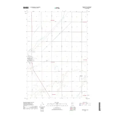
2019 Map of Wheaton East
USGS Topo · Published 2019About this map
Wheaton occupies the western edge of this agricultural landscape, where the rectilinear street grid—including Broadway, 1st Ave N, and Front St S—meets the sprawling farm plots of Traverse County. The terrain is defined by a complex drainage network vital to regional cultivation, featuring the winding Mustinka River and a system of engineered waterways such as County Ditch Number Twentyseven and County Ditch Number Four.
Find a feature on this map
51 named features on this map. Tap any name to fly to it.
Don’t see what you’re looking for? This feature index may not catch every label — zoom into the map to look around manually.
Map Details
Editions of this 2019 Wheaton East Map
This is the sole edition of this map. No revisions or reprints were ever made.
Other maps of this area

1915 · White Rock
USGS Topo · 1:62,500

1916 · Beardsley
USGS Topo · 1:62,500

1918 · White Rock
USGS Topo · 1:62,500

1918 · Beardsley
USGS Topo · 1:62,500

1950 · Graceville
USGS Topo · 1:62,500

1951 · Wheaton
USGS Topo · 1:62,500

1953 · Milbank
USGS Topo · 1:250,000

1958 · Milbank
USGS Topo · 1:250,000
1972 · Boisberg
USGS Topo · 1:24,000
1972 · Wheaton West
USGS Topo · 1:24,000