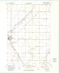
1974 Map of Wheaton East
USGS Topo · Published 1976About this map
The prairie landscape of Traverse County unfolds across this mid-1970s survey, centered on the grid of Wheaton and the agricultural lands of Lake Valley. The town serves as a focal point for the region's transport, where the Chicago Milwaukee St Paul and Pacific railroad cuts a diagonal line toward the southeast through Crooke. Water management is the defining human modification of this terrain, evidenced by a sophisticated network of canals such as County Ditch No 16 and County Ditch No 20 that channel water toward the Mustinka River and Lake Traverse. Genealogists will find several burial sites preserved here, including St Johns Cem and Wildwood Cem, alongside the small settlement of Dollymount in the southeastern corner. The map also documents local infrastructure ranging from a Gaging Station on the river to a rural Landing Strip.
Find a feature on this map
29 named features on this map. Tap any name to fly to it.
Don’t see what you’re looking for? This feature index may not catch every label — zoom into the map to look around manually.
Map Details
Editions of this 1974 Wheaton East Map
This is the sole edition of this map. No revisions or reprints were ever made.
Other maps of this area

1915 · White Rock
USGS Topo · 1:62,500

1916 · Beardsley
USGS Topo · 1:62,500

1918 · White Rock
USGS Topo · 1:62,500

1918 · Beardsley
USGS Topo · 1:62,500

1950 · Graceville
USGS Topo · 1:62,500

1951 · Wheaton
USGS Topo · 1:62,500

1953 · Milbank
USGS Topo · 1:250,000

1958 · Milbank
USGS Topo · 1:250,000
1972 · Boisberg
USGS Topo · 1:24,000
1972 · Wheaton West
USGS Topo · 1:24,000