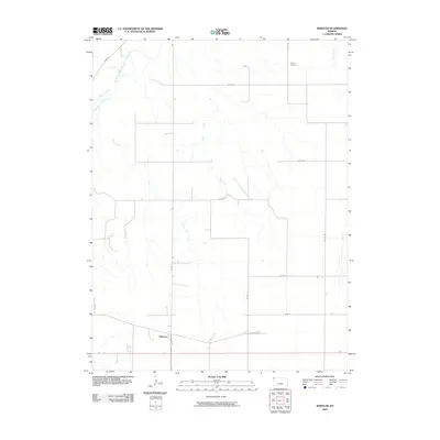
2009 Map of Wheeler
USGS Topo · Published 2009About this map
Wheeler serves as the primary settlement hub in this northwestern Kansas landscape, situated near the intersection of several county routes and a rail line. The terrain is defined by the drainage systems of the South Fork Republican River and its numerous tributaries, including Cleveland Run and Plum Cr. The map reveals a highly structured agricultural grid, where roads like Co Rd U and Co Rd 19 trace the section lines typical of the High Plains. A significant point of interest for genealogists and local historians is the Barley Cemetery in the northeastern portion of the quadrangle, located near Delay Creek. This 2009 survey highlights the enduring rural layout of Cheyenne County, where small watercourses like Bluff Creek and Valley Creek provide the only natural breaks in the geometric field patterns.
Find a feature on this map
19 named features on this map. Tap any name to fly to it.
Don’t see what you’re looking for? This feature index may not catch every label — zoom into the map to look around manually.
Map Details
Editions of this 2009 Wheeler Map
This is the sole edition of this map. No revisions or reprints were ever made.
Other maps of this area

1942 · St. Francis
USGS Topo · 1:62,500

1943 · St. Francis
USGS Topo · 1:62,500

1951 · St Francis
USGS Topo · 1:62,500

1951 · Bird City North
USGS Topo · 1:62,500

1951 · Bird City South
USGS Topo · 1:62,500

1952 · St Francis 3
USGS Topo · 1:62,500

1954 · Goodland
USGS Topo · 1:250,000

1956 · Goodland
USGS Topo · 1:250,000

1957 · Goodland
USGS Topo · 1:250,000

1976 · Bird City North
USGS Topo · 1:24,000