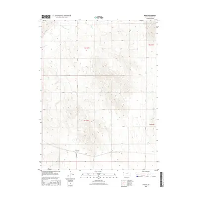
2015 Map of Wheeler
USGS Topo · Published 2015About this map
Wheeler serves as a central hub in this western Kansas landscape, situated where Kansas Ave meets the surrounding county road network. The settlement is defined by its relation to the regional topography, with the drainage of Valley Cr and Bluff Cr carving through the high plains toward the S Fork Republican River in the northwest. This 2015 survey illustrates a grid-dominated rural structure where section lines dictate the path of routes like Co Rd U and Co Rd S, while the natural meandering of waterways like Cleveland Run and Delano Cr provides the only break in the geometric order. For those researching family history in Cheyenne County, the inclusion of Barley Cem offers a specific point of interest for genealogical study within these townships.
Find a feature on this map
21 named features on this map. Tap any name to fly to it.
Don’t see what you’re looking for? This feature index may not catch every label — zoom into the map to look around manually.
Map Details
Editions of this 2015 Wheeler Map
This is the sole edition of this map. No revisions or reprints were ever made.
Other maps of this area

1942 · St. Francis
USGS Topo · 1:62,500

1943 · St. Francis
USGS Topo · 1:62,500

1951 · St Francis
USGS Topo · 1:62,500

1951 · Bird City North
USGS Topo · 1:62,500

1951 · Bird City South
USGS Topo · 1:62,500

1952 · St Francis 3
USGS Topo · 1:62,500

1954 · Goodland
USGS Topo · 1:250,000

1956 · Goodland
USGS Topo · 1:250,000

1957 · Goodland
USGS Topo · 1:250,000

1976 · Bird City North
USGS Topo · 1:24,000