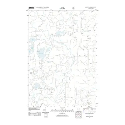
2011 Map of Wheeler Lake
USGS Topo · Published 2011About this map
Wheeler Lake and the surrounding Chequamegon-Nicolet National Forest region define this landscape, where a dense network of forest roads and glacial lakes creates a distinct recreation-oriented geography. The map captures the area just south of the community of Lakewood, featuring significant water bodies such as Waubee Lake, John Lake, and the expansive Munger Lake. Of particular interest to local historians is the Wheeler Lake Swimming Beach and the specialized infrastructure of the Lakewood Country Club Airport, which serve the seasonal and resident population. The hydrological character of Oconto County is well-represented by the North Branch Oconto River and its various tributaries like McCaslin Brook and Snow Falls Creek. Notable terrain features including Deer Island and Virgin Island within the primary lake add detail to the shoreline mapping, while a web of named forest routes like Cotton Tail Ln and National Forest Road 2101 provides a detailed look at the modern access patterns through this wooded lake country.
Find a feature on this map
52 named features on this map. Tap any name to fly to it.
Don’t see what you’re looking for? This feature index may not catch every label — zoom into the map to look around manually.
Map Details
Editions of this 2011 Wheeler Lake Map
This is the sole edition of this map. No revisions or reprints were ever made.
Other maps of this area

1940 · Thunder Mtn.
USGS Topo · 1:48,000

1942 · Breed
USGS Topo · 1:48,000

1942 · Wabeno
USGS Topo · 1:48,000

1950 · Wabeno
USGS Topo · 1:48,000

1951 · Wabeno
USGS Topo · 1:48,000

1951 · Thunder Mountain
USGS Topo · 1:48,000

1952 · Langlade
USGS Topo · 1:48,000

1952 · Mountain
USGS Topo · 1:48,000

1954 · Iron Mountain
USGS Topo · 1:250,000

1959 · Iron Mountain
USGS Topo · 1:250,000