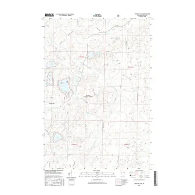
2015 Map of Wheeler Lake
USGS Topo · Published 2015About this map
Lakewood serves as a small population center within the sprawling boundaries of the Nicolet National Forest in this 2015 survey. The landscape is defined by its complex hydrography, featuring a high density of glacial lakes and springs that feed into the North Branch Oconto River. Notable water bodies such as Wheeler Lake, which contains Virgin Island and Deer Island, are central to the area's geography. The map reveals a network of forest service roads and local lanes, including McCaslin Tower Rd and Sullivan Spring Rd, which provide access to more secluded water features like Sullivan Springs and Tickey Springs. This era shows a clear intersection of public forest management and localized development, with numerous named lakes such as Waubee Lake, Paya Lake, and Munger Lake surrounded by a grid of townships like t33n r16e and t32n r17e.
Find a feature on this map
63 named features on this map. Tap any name to fly to it.
Don’t see what you’re looking for? This feature index may not catch every label — zoom into the map to look around manually.
Map Details
Editions of this 2015 Wheeler Lake Map
This is the sole edition of this map. No revisions or reprints were ever made.
Other maps of this area

1940 · Thunder Mtn.
USGS Topo · 1:48,000

1942 · Breed
USGS Topo · 1:48,000

1942 · Wabeno
USGS Topo · 1:48,000

1950 · Wabeno
USGS Topo · 1:48,000

1951 · Wabeno
USGS Topo · 1:48,000

1951 · Thunder Mountain
USGS Topo · 1:48,000

1952 · Langlade
USGS Topo · 1:48,000

1952 · Mountain
USGS Topo · 1:48,000

1954 · Iron Mountain
USGS Topo · 1:250,000

1959 · Iron Mountain
USGS Topo · 1:250,000