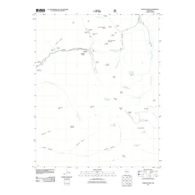
2011 Map of Wheeler Peak
USGS Topo · Published 2011About this map
Twining and Taos Ski Valley serve as the primary human hubs in this alpine landscape, located along the headwaters of the Rio Hondo. The area is deeply marked by its mining history, with numerous claims and operations such as the Frazer Mine, Highline Group Mine, and Amizette Prospects scattered across the high-elevation slopes. This 2011 survey captures the region's topographical prominence, centered on Wheeler Peak and surrounding summits like Mount Walter and Simpson Peak. The drainage systems of the West Fork Red River, Middle Fork Red River, and East Fork Red River define the northern territory, while high-altitude lakes including Williams Lake, Lost Lake, and Blue Lake sit in glacial basins. For the researcher, the map preserves the exact locations of older infrastructure like the Blue Lake Cabin, Ditch Cabin, and the Twining-Blue Lake Pack TRL, alongside early-century mining labels like the Rio Hondo Placer Group.
Find a feature on this map
65 named features on this map. Tap any name to fly to it.
Don’t see what you’re looking for? This feature index may not catch every label — zoom into the map to look around manually.
Map Details
Editions of this 2011 Wheeler Peak Map
This is the sole edition of this map. No revisions or reprints were ever made.
Other maps of this area

1954 · Raton
USGS Topo · 1:250,000

1958 · Raton
USGS Topo · 1:250,000

1963 · Wheeler Peak
USGS Topo · 1:24,000

1963 · Eagle Nest
USGS Topo · 1:24,000

1963 · Arroyo Seco
USGS Topo · 1:24,000

1963 · Red River Pass
USGS Topo · 1:24,000

1963 · Questa
USGS Topo · 1:24,000

1963 · Red River
USGS Topo · 1:24,000

1964 · Taos
USGS Topo · 1:24,000

1965 · Palo Flechado Pass
USGS Topo · 1:24,000