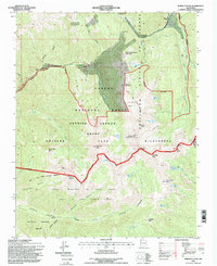
1995 Map of Wheeler Peak
USGS Topo · Published 1998About this map
Wheeler Peak dominates the landscape here as the highest point in New Mexico, anchoring a high-altitude wilderness within the Carson National Forest. The map captures the complex administrative and cultural boundaries of the Sangre de Cristo Mountains, where the Taos Pueblo Grant meets the Antoine Leroux Grant and the Antonio Martinez or Godoi Grant. These historical land tracts converge near high alpine basins and glacial lakes like Williams Lake and the sacred Blue Lake.
Find a feature on this map
51 named features on this map. Tap any name to fly to it.
Don’t see what you’re looking for? This feature index may not catch every label — zoom into the map to look around manually.
Map Details
Editions of this 1995 Wheeler Peak Map
This is the sole edition of this map. No revisions or reprints were ever made.
Other maps of this area

1954 · Raton
USGS Topo · 1:250,000

1958 · Raton
USGS Topo · 1:250,000

1963 · Wheeler Peak
USGS Topo · 1:24,000

1963 · Eagle Nest
USGS Topo · 1:24,000

1963 · Arroyo Seco
USGS Topo · 1:24,000

1963 · Red River Pass
USGS Topo · 1:24,000

1963 · Questa
USGS Topo · 1:24,000

1963 · Red River
USGS Topo · 1:24,000

1964 · Taos
USGS Topo · 1:24,000

1965 · Palo Flechado Pass
USGS Topo · 1:24,000