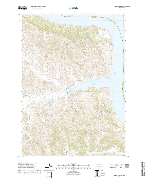
2021 Map of Whetstone Bay
USGS Topo · Published 2021About this map
Lake Francis Case and the wide expanse of Whetstone Bay dominate this stretch of the Missouri River on the border of Gregory and Charles Mix counties. The landscape is defined by the intricate network of drainages feeding into the reservoir, including the N Fork Whetstone Cr, Whetstone Cr, and Burnt Rock Cr. These watercourses carve through the high plains, creating a complex series of ridges and draws that dictate the local transportation network.
Find a feature on this map
23 named features on this map. Tap any name to fly to it.
Don’t see what you’re looking for? This feature index may not catch every label — zoom into the map to look around manually.
Map Details
Editions of this 2021 Whetstone Bay Map
This is the sole edition of this map. No revisions or reprints were ever made.
Other maps of this area

1955 · Mitchell
USGS Topo · 1:250,000

1959 · Mitchell
USGS Topo · 1:250,000

1964 · Campbell Creek
USGS Topo · 1:24,000

1964 · Herrick NE
USGS Topo · 1:24,000

1964 · St. Charles
USGS Topo · 1:24,000

1964 · Whetstone Bay
USGS Topo · 1:24,000
1964 · South Scalp Creek
USGS Topo · 1:24,000
1964 · Bonesteel
USGS Topo · 1:24,000

1971 · Lucas SE
USGS Topo · 1:24,000

1979 · Castalia
USGS Topo · 1:24,000