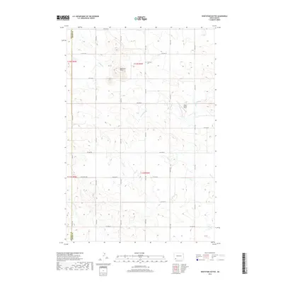
2018 Map of Whetstone Buttes
USGS Topo · Published 2018About this map
Whetstone Buttes dominate this portion of the North Dakota landscape along the Bowman and Adams County line. The terrain is defined by its drainage patterns, with S Cedar Cr and Russian Slough cutting through the northern sections while Duck Cr flows to the southeast. Human presence is marked primarily by a sparse grid of section-line roads and the isolated Whetstone Cem, which serves as a significant landmark for genealogists tracing early families in this rural township. The inclusion of the Hagen Private Airport illustrates the continued importance of small-scale aviation in managing these expansive agricultural and ranching tracts. This 2018 survey provides a precise look at the land's elevation and hydrology, showing how the natural coulees and sloughs dictate the placement of local infrastructure.
Find a feature on this map
26 named features on this map. Tap any name to fly to it.
Don’t see what you’re looking for? This feature index may not catch every label — zoom into the map to look around manually.
Map Details
Editions of this 2018 Whetstone Buttes Map
This is the sole edition of this map. No revisions or reprints were ever made.
Other maps of this area

1953 · Dickinson
USGS Topo · 1:250,000

1957 · Dickinson
USGS Topo · 1:250,000

1969 · Gascoyne
USGS Topo · 1:24,000

1969 · Reeder
USGS Topo · 1:24,000

1969 · Scranton NE
USGS Topo · 1:24,000

1973 · Warnke Hill
USGS Topo · 1:24,000

1973 · Cedar Lake
USGS Topo · 1:24,000

1973 · Enterprise School
USGS Topo · 1:24,000

1980 · Mott
USGS Topo · 1:100,000

1981 · Bowman
USGS Topo · 1:100,000