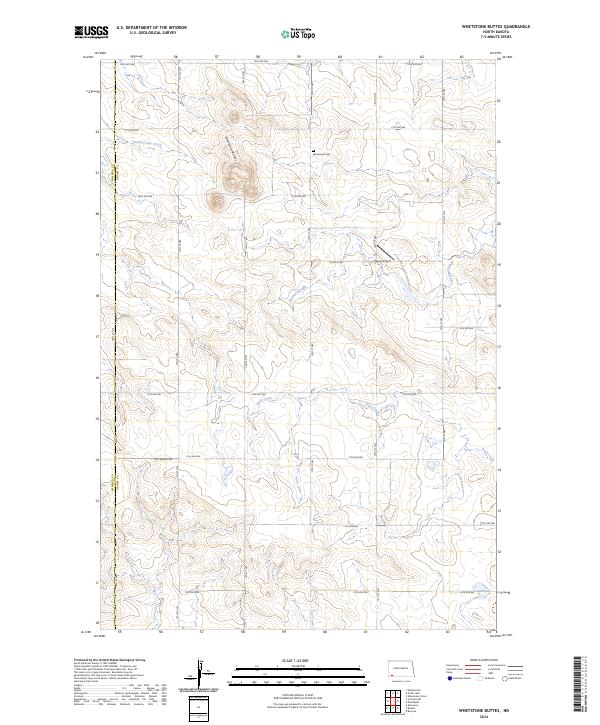
2024 Map of Whetstone Buttes
USGS Topo · Published 2024About this map
Whetstone Buttes rise above the high plains of Adams County, anchoring a landscape shaped by seasonal watercourses and the rigid geometry of the Public Land Survey System. The area is defined by its wide-open ranching or farming character, where infrastructure is limited to a sparse grid of section-line roads like 18th Ave NW and 17th St NW. Vital local landmarks such as the Whetstone Cem and Hagen Airport serve as the primary human touchpoints in this expansive terrain. Drainage is managed by meandering features including South Cedar Creek, Russian Slough, and Duck Creek, which carve subtle relief into the prairie. The map also delineates the jurisdictional boundary between Bowman and Adams counties, illustrating how political lines bisect this otherwise continuous topographic expanse.
Find a feature on this map
26 named features on this map. Tap any name to fly to it.
Don’t see what you’re looking for? This feature index may not catch every label — zoom into the map to look around manually.
Map Details
Editions of this 2024 Whetstone Buttes Map
This is the sole edition of this map. No revisions or reprints were ever made.
Other maps of this area

1953 · Dickinson
USGS Topo · 1:250,000

1957 · Dickinson
USGS Topo · 1:250,000

1969 · Gascoyne
USGS Topo · 1:24,000

1969 · Reeder
USGS Topo · 1:24,000

1969 · Scranton NE
USGS Topo · 1:24,000

1973 · Warnke Hill
USGS Topo · 1:24,000

1973 · Cedar Lake
USGS Topo · 1:24,000

1973 · Enterprise School
USGS Topo · 1:24,000

1980 · Mott
USGS Topo · 1:100,000

1981 · Bowman
USGS Topo · 1:100,000