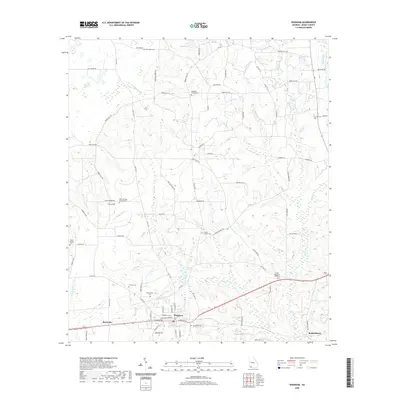
2020 Map of Whigham
USGS Topo · Published 2020About this map
Whigham and the surrounding Grady County countryside are defined by a complex network of creeks and family-named roads that connect small rural settlements. This 2020 landscape shows the town's layout near the Whigham Cem and Woodlawn Cem, with residential development concentrated along Old Hwy 84. The drainage pattern is heavily dictated by Wolf Cr and McElvey Br, which flow through a region historically rooted in agriculture. Genealogists will find several rural burial grounds including Union Springs Church Cem near Curry Hill and the Trinity Church Cem. The map captures a contemporary look at older crossroads like Boydville and Roddenberry, where the terrain transitions toward Ezell Lake and the wetlands of Buss Cr. Numerous small cemeteries such as Thomas Cem and Paulk Cem are carefully noted, providing valuable points of reference for local family history research.
Find a feature on this map
89 named features on this map. Tap any name to fly to it.
Don’t see what you’re looking for? This feature index may not catch every label — zoom into the map to look around manually.
Map Details
Editions of this 2020 Whigham Map
This is the sole edition of this map. No revisions or reprints were ever made.
Other maps of this area

1953 · Dothan
USGS Topo · 1:250,000

1954 · Dothan
USGS Topo · 1:250,000

1954 · Tallahassee
USGS Topo · 1:250,000

1955 · Dothan
USGS Topo · 1:250,000

1955 · Whigham
USGS Topo · 1:62,500

1956 · Cairo
USGS Topo · 1:62,500

1959 · Tallahassee
USGS Topo · 1:250,000

1960 · Tallahassee
USGS Topo · 1:250,000

1971 · Gee Pond
USGS Topo · 1:24,000

1971 · Vada
USGS Topo · 1:24,000