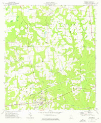
1974 Map of Whigham
USGS Topo · Published 1976About this map
Whigham serves as the central hub for this portion of Grady County, where the Seaboard Coast Line railroad dictates the local geometry of settlement and commerce. In the mid-1970s, the landscape is defined by a dense network of small rural institutions and family-named landmarks. Numerous country churches like Spring Hill Ch and Mt Pilgrim Ch anchor the surrounding timber and farm country, while several cemeteries, including Woodlawn Cem and New Hope Cem, provide essential data points for local genealogists. The map also captures smaller communities and named sites such as Boydville, Roddenberry, and the curiously named Peoples Still. The terrain is deeply etched by a complex drainage system featuring Tired Creek, Wolf Creek, and Sweetwater Branch, creating the varied elevation seen at Curry Hill.
Find a feature on this map
31 named features on this map. Tap any name to fly to it.
Don’t see what you’re looking for? This feature index may not catch every label — zoom into the map to look around manually.
Map Details
Editions of this 1974 Whigham Map
This is the sole edition of this map. No revisions or reprints were ever made.
Other maps of this area

1953 · Dothan
USGS Topo · 1:250,000

1954 · Dothan
USGS Topo · 1:250,000

1954 · Tallahassee
USGS Topo · 1:250,000

1955 · Dothan
USGS Topo · 1:250,000

1955 · Whigham
USGS Topo · 1:62,500

1956 · Cairo
USGS Topo · 1:62,500

1959 · Tallahassee
USGS Topo · 1:250,000

1960 · Tallahassee
USGS Topo · 1:250,000

1971 · Gee Pond
USGS Topo · 1:24,000

1971 · Vada
USGS Topo · 1:24,000