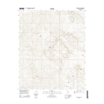
2015 Map of Whipple Wash
USGS Topo · Published 2015About this map
Whipple Mountains dominate this arid landscape within the Mojave Desert of San Bernardino County. The map details a complex network of ephemeral drainages, including the prominent Whipple Wash, Copper Basin Wash, and Bennett Wash, which carve through the high-elevation terrain. Of particular interest to industrial historians is the presence of the Colorado River Aqueduct as it traverses the southeastern corner, featuring technical infrastructure such as the Whipple Mountain Tunnel and the Whipple Mountain Adit.
Find a feature on this map
16 named features on this map. Tap any name to fly to it.
Don’t see what you’re looking for? This feature index may not catch every label — zoom into the map to look around manually.
Map Details
Editions of this 2015 Whipple Wash Map
This is the sole edition of this map. No revisions or reprints were ever made.
Other maps of this area

1911 · Parker
USGS Topo · 1:125,000

1943 · Giers Basin
USGS Topo · 1:62,500

1943 · Whipple Mts.
USGS Topo · 1:62,500

1943 · Parker
USGS Topo · 1:62,500

1949 · Parker
USGS Topo · 1:62,500

1950 · Parker Dam Area
USGS Topo · 1:62,500

1950 · Parker
USGS Topo · 1:62,500

1950 · Whipple Mts
USGS Topo · 1:62,500

1952 · Whipple Mts
USGS Topo · 1:62,500

1954 · Needles
USGS Topo · 1:250,000