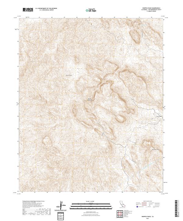
2021 Map of Whipple Wash
USGS Topo · Published 2021About this map
The Whipple Mountains dominate this high-desert landscape in eastern San Bernardino County, where dramatic elevation changes define the terrain. The map captures a critical piece of regional infrastructure, the Colorado River Aqueduct, as it cuts through the complex topography of the Mojave Desert. This arid environment is marked by scattered natural landmarks such as Willow Spring and the prominent heights of Monument Peak. To the southeast, the Copper Basin area indicates a history of geologic interest and resource exploration. The transport network is sparse, consisting primarily of utility and access routes like Trail End Camp Rd and Bowmans Wash Rd, which navigate the deep washes and ridgelines that characterize this corner of the California desert during the early 21st century.
Find a feature on this map
12 named features on this map. Tap any name to fly to it.
Don’t see what you’re looking for? This feature index may not catch every label — zoom into the map to look around manually.
Map Details
Editions of this 2021 Whipple Wash Map
This is the sole edition of this map. No revisions or reprints were ever made.
Other maps of this area

1911 · Parker
USGS Topo · 1:125,000

1943 · Giers Basin
USGS Topo · 1:62,500

1943 · Whipple Mts.
USGS Topo · 1:62,500

1943 · Parker
USGS Topo · 1:62,500

1949 · Parker
USGS Topo · 1:62,500

1950 · Parker Dam Area
USGS Topo · 1:62,500

1950 · Parker
USGS Topo · 1:62,500

1950 · Whipple Mts
USGS Topo · 1:62,500

1952 · Whipple Mts
USGS Topo · 1:62,500

1954 · Needles
USGS Topo · 1:250,000