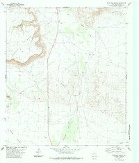
1983 Map of Whirlwind Spring
USGS Topo · Published 1984About this map
Kokernot Mesa dominates the northwestern reaches of this Brewster County landscape, its steep escarpments giving way to the broad expanse of Green Valley to the south. This 1983 survey records a region defined by water management and resource extraction in a semi-arid environment, marked by numerous Tanks and multiple Drill Holes scattered across the basin. The drainage network is particularly prominent, centered on the winding path of Calamity Creek and the southern flow of Butcherknife Draw. Evidence of local industry and transport appears in the form of a Gravel Pit near the northern boundary and a network of Jeep Trails that provide access to the high ground of Bear Canyon. The namesake Whirlwind Spring serves as a vital point of interest along the western slopes, illustrating the relationship between the rugged geology and essential water sources.
Find a feature on this map
11 named features on this map. Tap any name to fly to it.
Don’t see what you’re looking for? This feature index may not catch every label — zoom into the map to look around manually.
Map Details
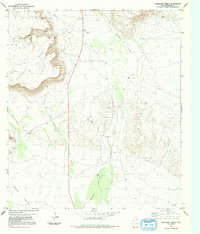
Editions of this 1983 Whirlwind Spring Map
2 editions found
Other maps of this area

1895 · Alpine
USGS Topo · 1:125,000

1917 · Santiago Peak
USGS Topo · 1:62,500

1917 · Buck Hill
USGS Topo · 1:62,500

1918 · Bone Spring
USGS Topo · 1:125,000

1918 · Buck Hill
USGS Topo · 1:62,500

1918 · Santiago Peak
USGS Topo · 1:62,500

1920 · Monument Spring
USGS Topo · 1:62,500

1921 · Monument Spring
USGS Topo · 1:62,500

1925 · Buck Hill
USGS Topo · 1:62,500
1938 · Santiago Peak
USGS Topo · 1:62,500