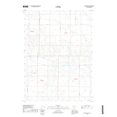
2017 Map of Whistle Creek NE
USGS Topo · Published 2017About this map
The Niobrara River carves a central path through this section of Sioux County, defining the agricultural character of the high plains landscape. Irrigation infrastructure is prominent along the river valley, where the Sandoz Ditch and Mentlen Ditch divert water to support the surrounding ranchlands. This network of man-made waterways alongside natural features like Whistle Creek and Barngrover Creek illustrates the ongoing importance of water management in Nebraska's western panhandle.
Find a feature on this map
15 named features on this map. Tap any name to fly to it.
Don’t see what you’re looking for? This feature index may not catch every label — zoom into the map to look around manually.
Map Details
Editions of this 2017 Whistle Creek NE Map
This is the sole edition of this map. No revisions or reprints were ever made.
Other maps of this area

1899 · Whistle Creek
USGS Topo · 1:125,000

1951 · Marsland
USGS Topo · 1:62,500

1955 · Alliance
USGS Topo · 1:250,000

1957 · Alliance
USGS Topo · 1:250,000

1958 · Alliance
USGS Topo · 1:250,000

1980 · Kyle Creek
USGS Topo · 1:24,000

1980 · Dead Mans Creek
USGS Topo · 1:24,000
1980 · Glen
USGS Topo · 1:24,000
1983 · Marsland SW
USGS Topo · 1:24,000
1983 · Marsland NW
USGS Topo · 1:24,000