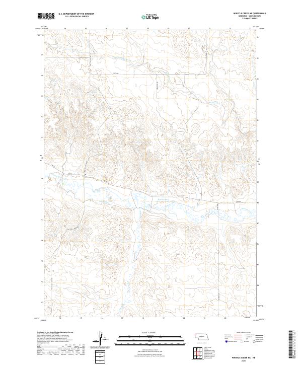
2021 Map of Whistle Creek NE
USGS Topo · Published 2021About this map
The Niobrara River flows through the southern half of this Sioux County landscape, defining a corridor of agricultural and hydrologic activity in a territory characterized by its section-line boundaries. Water management is a primary feature of the valley here, evidenced by the presence of the Sandoz Ditch and Mentlen Ditch, which redirect flow across the terrain south of River Rd. These irrigation works represent the enduring ranching and farming infrastructure necessary for life in the Nebraska panhandle.
Find a feature on this map
15 named features on this map. Tap any name to fly to it.
Don’t see what you’re looking for? This feature index may not catch every label — zoom into the map to look around manually.
Map Details
Editions of this 2021 Whistle Creek NE Map
This is the sole edition of this map. No revisions or reprints were ever made.
Other maps of this area

1899 · Whistle Creek
USGS Topo · 1:125,000

1951 · Marsland
USGS Topo · 1:62,500

1955 · Alliance
USGS Topo · 1:250,000

1957 · Alliance
USGS Topo · 1:250,000

1958 · Alliance
USGS Topo · 1:250,000

1980 · Kyle Creek
USGS Topo · 1:24,000

1980 · Dead Mans Creek
USGS Topo · 1:24,000
1980 · Glen
USGS Topo · 1:24,000
1983 · Marsland SW
USGS Topo · 1:24,000
1983 · Marsland NW
USGS Topo · 1:24,000