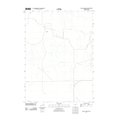
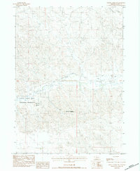
2011 Map of Whistle Creek SW
USGS Topo · Published 2011About this map
The Agate Fossil Beds Natl Monument occupies a portion of this Sioux County landscape, protecting a region significant for its paleontological history. The terrain is defined by the high plains of Royville Flat and a network of ephemeral drainage systems, including Whistle Creek, Coyote Springs Creek, and South Branch Snake Creek. Human activity is primarily centered around ranching, as evidenced by the Johnson Ranch in the north and the Star-D Ranch in the south. The road network reflects the practicalities of rural life, with functional routes like White Rock Rd and the descriptive Cut Across Rd. The name Pink School House Rd suggests the historical location of a local landmark, preserving a trace of earlier rural community structures within this sparsely settled ranching territory.
Find a feature on this map
10 named features on this map. Tap any name to fly to it.
Don’t see what you’re looking for? This feature index may not catch every label — zoom into the map to look around manually.
Map Details
Editions of this 2011 Whistle Creek SW Map
This is the sole edition of this map. No revisions or reprints were ever made.
Other maps of this area

1899 · Whistle Creek
USGS Topo · 1:125,000

1955 · Alliance
USGS Topo · 1:250,000

1957 · Alliance
USGS Topo · 1:250,000

1958 · Alliance
USGS Topo · 1:250,000

1979 · Mount Edna
USGS Topo · 1:24,000

1979 · Agate
USGS Topo · 1:24,000
1983 · Chalk Buttes NE
USGS Topo · 1:24,000
1983 · University Lake NW
USGS Topo · 1:24,000
1983 · University Lake NE
USGS Topo · 1:24,000
1983 · Whistle Creek NW
USGS Topo · 1:24,000