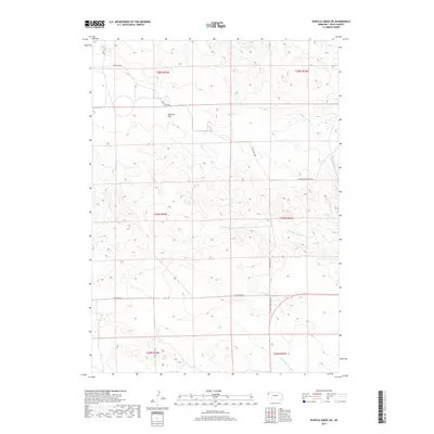
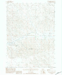
2017 Map of Whistle Creek SW
USGS Topo · Published 2017About this map
Royville Flat sits at the heart of this high plains landscape in Sioux County, where the drainages of Whistle Cr and Coyote Springs Cr define the subtle topography. This corner of Nebraska remains largely defined by the original Public Land Survey System grid, which is reflected in the layout of the local road network. The presence of Pink School House Rd hints at the location of former rural education centers that once served the scattered ranching community. In the southern portion of the map, the headwaters of S Br Snake Cr begin their descent through the breaks. The simple infrastructure, marked by routes like White Rock Rd and the aptly named Cut Across Rd, illustrates the vast distances and functional geography of the Nebraska Panhandle.
Find a feature on this map
13 named features on this map. Tap any name to fly to it.
Don’t see what you’re looking for? This feature index may not catch every label — zoom into the map to look around manually.
Map Details
Editions of this 2017 Whistle Creek SW Map
This is the sole edition of this map. No revisions or reprints were ever made.
Other maps of this area

1899 · Whistle Creek
USGS Topo · 1:125,000

1955 · Alliance
USGS Topo · 1:250,000

1957 · Alliance
USGS Topo · 1:250,000

1958 · Alliance
USGS Topo · 1:250,000

1979 · Mount Edna
USGS Topo · 1:24,000

1979 · Agate
USGS Topo · 1:24,000
1983 · Chalk Buttes NE
USGS Topo · 1:24,000
1983 · University Lake NW
USGS Topo · 1:24,000
1983 · University Lake NE
USGS Topo · 1:24,000
1983 · Whistle Creek NW
USGS Topo · 1:24,000