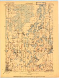
1902 Map of White Bear
USGS Topo · Published 1918About this map
White Bear Lake and its surrounding glacial lake district serve as the focal point for this survey conducted just before the turn of the century. The landscape is defined by an intricate network of water bodies, from the sprawling Pleasant Lake to the extensive Wiregrass Marsh in the northwest. This era shows the region's developing infrastructure, specifically the critical water management systems for the growing Twin Cities area, evidenced by the Minneapolis Reservoir, several Pumping Stations, and Artesian Wells near Centerville.
Find a feature on this map
84 named features on this map. Tap any name to fly to it.
Don’t see what you’re looking for? This feature index may not catch every label — zoom into the map to look around manually.
Map Details
Editions of this 1902 White Bear Map
4 editions found
Other maps of this area

1896 · Minneapolis
USGS Topo · 1:62,500

1896 · St. Paul
USGS Topo · 1:62,500

1901 · Minneapolis
USGS Topo · 1:62,500

1902 · White Bear
USGS Topo · 1:62,500

1902 · Anoka
USGS Topo · 1:62,500

1916 · St. Francis
USGS Topo · 1:62,500

1919 · St. Francis
USGS Topo · 1:62,500

1946 · Hudson
USGS Topo · 1:62,500

1948 · Stillwater
USGS Topo · 1:62,500

1949 · Hudson
USGS Topo · 1:62,500