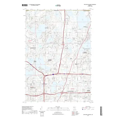
2019 Map of White Bear Lake West
USGS Topo · Published 2019About this map
Pleasant Lake and Deep Lake anchor the northern landscape of Ramsey County, where the private residential community of North Oaks is surrounded by a complex network of glacial water bodies and wetlands. The region transitions from the suburban corridors of Shoreview and Vadnais Heights into the more open spaces toward Lino Lakes at the Anoka County line. Transport infrastructure is prominent, with the rail intersection at Cardigan Junction and the small-scale aviation operations at Benson Airport in the northeast corner near Hugo. Local heritage is preserved at sites like Saint Mary of the Lake Cem and Union Cem, while the lakefront character of White Bear Lake and Bald Eagle remains central to the area's geography. The map reveals the intricate water management system connecting Vadnais Lake and Sucker Lake, vital components of the regional watershed that define the boundaries of local settlements.
Find a feature on this map
179 named features on this map. Tap any name to fly to it.
Don’t see what you’re looking for? This feature index may not catch every label — zoom into the map to look around manually.
Map Details
Editions of this 2019 White Bear Lake West Map
This is the sole edition of this map. No revisions or reprints were ever made.
Other maps of this area

1896 · St. Paul
USGS Topo · 1:62,500

1902 · White Bear
USGS Topo · 1:62,500

1946 · Hudson
USGS Topo · 1:62,500

1948 · Stillwater
USGS Topo · 1:62,500

1949 · Hudson
USGS Topo · 1:62,500

1949 · Stillwater
USGS Topo · 1:62,500

1949 · Lake Elmo
USGS Topo · 1:24,000

1950 · Lake Elmo
USGS Topo · 1:24,000

1951 · White Bear Lake East
USGS Topo · 1:24,000

1951 · St. Paul West
USGS Topo · 1:24,000