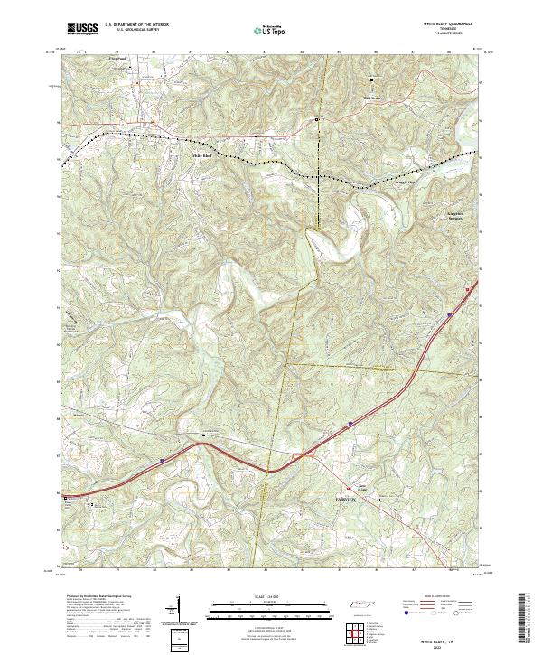
2022 Map of White Bluff
USGS Topo · Published 2022About this map
White Bluff serves as a central hub in this western Middle Tennessee landscape, where the headwaters of Turnbull Creek and Big Turnbull Creek carve through the terrain. The map captures a detailed network of rural settlements, including Bell Town, Craggie Hope, and Kingston Springs to the east, and Burns to the southwest. The area's deep-rooted family history is evidenced by numerous small burial grounds such as Olds Cem, Carothers Cem, and the Brown Family Cem. The presence of the Dripping Springs Farm Airport and a complex web of local roads like Old Charlotte Rd and Joslin Branch Rd illustrate the modern evolution of these historic communities. Geographically, the map also documents the crossing of several county lines, where Dickson, Cheatham, and Williamson counties meet amidst a landscape defined by significant springs and hollows like Buck Spring and Wildcat Hollow.
Find a feature on this map
148 named features on this map. Tap any name to fly to it.
Don’t see what you’re looking for? This feature index may not catch every label — zoom into the map to look around manually.
Map Details
Editions of this 2022 White Bluff Map
This is the sole edition of this map. No revisions or reprints were ever made.
Other maps of this area

1901 · Colombia
USGS Topo · 1:125,000

1930 · White Bluff
USGS Topo · 1:62,500

1933 · White Bluff
USGS Topo · 1:62,500

1936 · Burns
USGS Topo · 1:24,000

1936 · Craigfield
USGS Topo · 1:24,000

1936 · Lyles
USGS Topo · 1:24,000

1951 · Fairview
USGS Topo · 1:24,000
1953 · Lyles
USGS Topo · 1:24,000
1953 · Craigfield
USGS Topo · 1:24,000

1953 · Burns
USGS Topo · 1:24,000