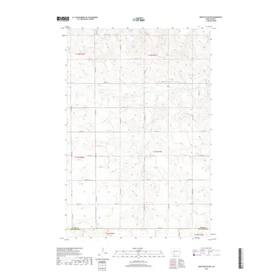
2018 Map of White Butte NW
USGS Topo · Published 2018About this map
Plum Cr meanders through the heart of this rural landscape, carving a subtle path across the boundary between Stark and Hettinger counties. The terrain is organized by a strict grid of section lines and gravel roads, reflecting the systematic division of the North Dakota prairie for agricultural use. While no major towns are present, the map provides an exacting look at the rural infrastructure of the 2010s, including the intersection of 46th St SW and 97th Ave SW. This area, primarily within Stark and Hettinger Counties, illustrates the expansive, open character of the Great Plains, where the landscape is defined by the precise placement of arterial roads like 54th St SW and 92nd Ave SW amidst undulating contours.
Find a feature on this map
24 named features on this map. Tap any name to fly to it.
Don’t see what you’re looking for? This feature index may not catch every label — zoom into the map to look around manually.
Map Details
Editions of this 2018 White Butte NW Map
This is the sole edition of this map. No revisions or reprints were ever made.
Other maps of this area

1953 · Dickinson
USGS Topo · 1:250,000

1957 · Dickinson
USGS Topo · 1:250,000

1960 · White Butte West
USGS Topo · 1:24,000

1960 · White Butte NW
USGS Topo · 1:24,000

1960 · White Butte NE
USGS Topo · 1:24,000

1960 · White Butte East
USGS Topo · 1:24,000

1973 · Bratburg Butte
USGS Topo · 1:24,000

1973 · Lefor
USGS Topo · 1:24,000

1973 · Richardton SE
USGS Topo · 1:24,000

1973 · Gladstone
USGS Topo · 1:24,000