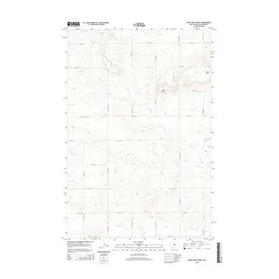
2014 Map of White Butte West
USGS Topo · Published 2014About this map
White Butte and Bull Butte define the topography of this high plains landscape in Hettinger County. The area is characterized by a precise grid of rural section roads, including 94th Ave SW and 55th St SW, which facilitate movement through the agricultural terrain. The drainage systems of Thirtymile Cr and Plum Cr cut through the elevation, showing the natural water patterns in an otherwise structured environment. This 2014 survey reflects the modern rural layout of southwestern North Dakota, where the intersection of natural landmarks and late 20th-century road infrastructure shapes the local geography.
Find a feature on this map
19 named features on this map. Tap any name to fly to it.
Don’t see what you’re looking for? This feature index may not catch every label — zoom into the map to look around manually.
Map Details
Editions of this 2014 White Butte West Map
This is the sole edition of this map. No revisions or reprints were ever made.
Other maps of this area

1953 · Dickinson
USGS Topo · 1:250,000

1957 · Dickinson
USGS Topo · 1:250,000

1960 · White Butte West
USGS Topo · 1:24,000

1960 · White Butte NW
USGS Topo · 1:24,000

1960 · White Butte NE
USGS Topo · 1:24,000

1960 · White Butte East
USGS Topo · 1:24,000

1966 · Mott NW
USGS Topo · 1:24,000

1966 · Regent
USGS Topo · 1:24,000

1966 · Mott North
USGS Topo · 1:24,000

1973 · Lefor
USGS Topo · 1:24,000