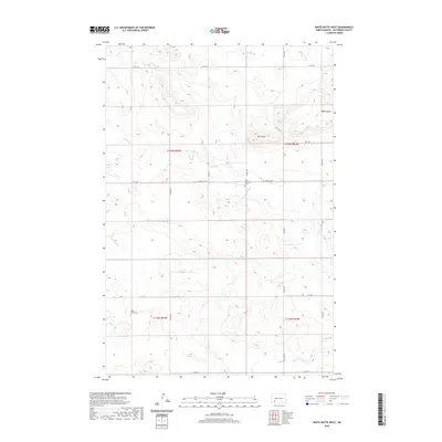
2020 Map of White Butte West
USGS Topo · Published 2020About this map
White Butte and Bull Butte dominate the landscape of Hettinger County, rising above the rolling plains where the watercourses of Plum Cr and Thirtymile Cr carve through the terrain. This rural township is defined by a grid of section lines and gravel roads, such as St Michael's Rd, which connect isolated homesteads and local landmarks. For those tracing family history in this part of North Dakota, the presence of Saint Michaels Cem and Black Butte Cem provides vital geographic anchors for early settlers. The map illustrates a ranching and farming landscape where topography dictated the placement of roads and property boundaries, maintaining a settlement pattern that has changed little over the decades.
Find a feature on this map
21 named features on this map. Tap any name to fly to it.
Don’t see what you’re looking for? This feature index may not catch every label — zoom into the map to look around manually.
Map Details
Editions of this 2020 White Butte West Map
This is the sole edition of this map. No revisions or reprints were ever made.
Other maps of this area

1953 · Dickinson
USGS Topo · 1:250,000

1957 · Dickinson
USGS Topo · 1:250,000

1960 · White Butte West
USGS Topo · 1:24,000

1960 · White Butte NW
USGS Topo · 1:24,000

1960 · White Butte NE
USGS Topo · 1:24,000

1960 · White Butte East
USGS Topo · 1:24,000

1966 · Mott NW
USGS Topo · 1:24,000

1966 · Regent
USGS Topo · 1:24,000

1966 · Mott North
USGS Topo · 1:24,000

1973 · Lefor
USGS Topo · 1:24,000