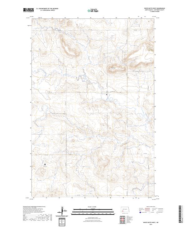
2024 Map of White Butte West
USGS Topo · Published 2024About this map
Thirtymile Creek winds through this section of the Great Plains, defining the drainage patterns of a landscape marked by prominent topographic rises and conservation lands. The Hettinger County Waterfowl Production Area occupies a significant portion of the western terrain, preserving vital habitat within the prairie pothole region. This 2024 survey reflects the enduring rural character of the county, where the rectilinear grid of local roads like 95 Ave SW and 61 St SW segments the land into large agricultural tracts. Local heritage is anchored by quiet landmarks such as Bull Butte and small burial grounds including Saint Michaels Cem and Black Butte Cem, which serve as vital touchstones for family historians tracing early settlement patterns in this part of North Dakota.
Find a feature on this map
20 named features on this map. Tap any name to fly to it.
Don’t see what you’re looking for? This feature index may not catch every label — zoom into the map to look around manually.
Map Details
Editions of this 2024 White Butte West Map
This is the sole edition of this map. No revisions or reprints were ever made.
Other maps of this area

1953 · Dickinson
USGS Topo · 1:250,000

1957 · Dickinson
USGS Topo · 1:250,000

1960 · White Butte West
USGS Topo · 1:24,000

1960 · White Butte NW
USGS Topo · 1:24,000

1960 · White Butte NE
USGS Topo · 1:24,000

1960 · White Butte East
USGS Topo · 1:24,000

1966 · Mott NW
USGS Topo · 1:24,000

1966 · Regent
USGS Topo · 1:24,000

1966 · Mott North
USGS Topo · 1:24,000

1973 · Lefor
USGS Topo · 1:24,000