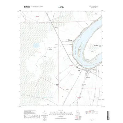
2020 Map of White Castle
USGS Topo · Published 2020About this map
White Castle and the surrounding riverfront communities along the Mississippi River demonstrate the enduring footprint of Louisiana's plantation and parish history. The landscape is defined by the sharp Bayou Goula Bend and a series of named settlements like Blythwood, Tally Ho, and Catherine that follow the natural levees. A high density of cemeteries and markers, including the Vaughn Family Tomb and Our Lady of Prompt Succor Cem, provides deep genealogical value for researchers tracing local lineages. Inland from the river, the terrain transitions into a network of drainage systems like Bayou Tigre and Bayou la Butte. In the eastern section, the St. Gabriel area contains the Patients Hansen's Disease Cem, a significant site reflecting the specialized social history of Iberville Parish. The map reveals how the modern road network, including River Rd and Augusta Rd, preserves the boundaries of older land holdings and historical reaches.
Find a feature on this map
98 named features on this map. Tap any name to fly to it.
Don’t see what you’re looking for? This feature index may not catch every label — zoom into the map to look around manually.
Map Details
Editions of this 2020 White Castle Map
This is the sole edition of this map. No revisions or reprints were ever made.
Other maps of this area

1908 · Baton Rouge
USGS Topo · 1:62,500

1935 · Chicot Lake
USGS Topo · 1:62,500

1936 · White Castle
USGS Topo · 1:62,500

1939 · Baton Rouge
USGS Topo · 1:62,500

1940 · Grosse Tete
USGS Topo · 1:62,500

1953 · Crescent
USGS Topo · 1:24,000

1953 · Plaquemine
USGS Topo · 1:24,000

1953 · Addis
USGS Topo · 1:24,000

1953 · St. Gabriel
USGS Topo · 1:24,000
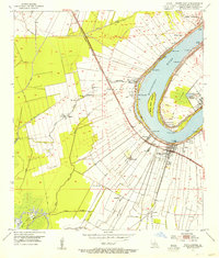
1953 · White Castle
USGS Topo · 1:24,000