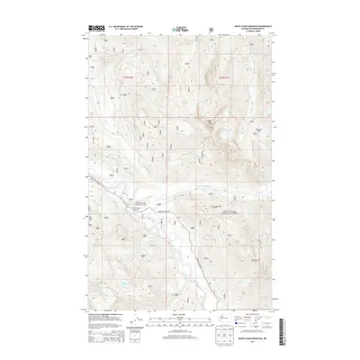
2014 Map of White Chuck Mountain
USGS Topo · Published 2014About this map
Mount Baker National Forest contains the sharp topography and watershed network of the northern Cascades, defined here by the confluence of the Sauk River and the White Chuck River. This 2014 survey captures a landscape of intense relief and outdoor utility, where the Mountain Loop Hwy provides the primary access to the backcountry. Notable recreational infrastructure includes the White Chuck Campground and a specialized Whitewater Launch along the riverbanks, reflecting the area's importance for river-based transit and modern forest management.
Find a feature on this map
30 named features on this map. Tap any name to fly to it.
Don’t see what you’re looking for? This feature index may not catch every label — zoom into the map to look around manually.
Map Details
Editions of this 2014 White Chuck Mountain Map
This is the sole edition of this map. No revisions or reprints were ever made.
Other maps of this area

1899 · Glacier Peak
USGS Topo · 1:125,000

1899 · Stillaguamish
USGS Topo · 1:125,000

1901 · Glacier Peak
USGS Topo · 1:125,000

1901 · Stilaguamish
USGS Topo · 1:125,000

1955 · Concrete
USGS Topo · 1:250,000

1957 · Silverton
USGS Topo · 1:62,500

1958 · Concrete
USGS Topo · 1:250,000

1962 · Concrete
USGS Topo · 1:250,000
1966 · Huckleberry Mtn
USGS Topo · 1:24,000
1966 · Sloan Peak
USGS Topo · 1:24,000