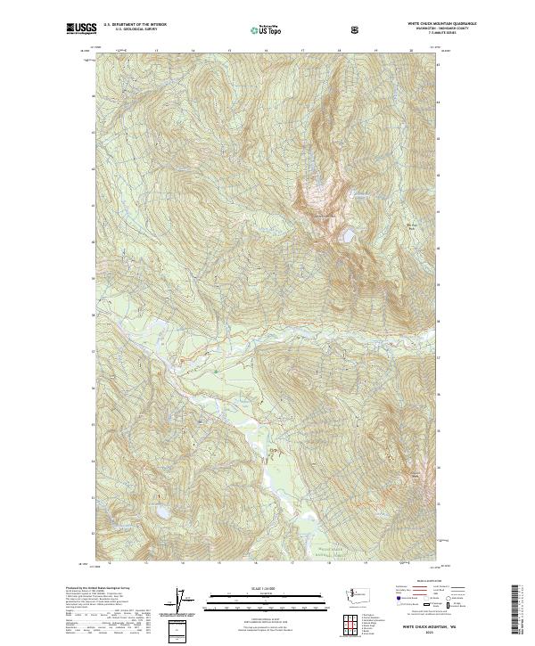
2023 Map of White Chuck Mountain
USGS Topo · Published 2023About this map
White Chuck Mtn dominates the center of this landscape, surrounded by a complex network of glacial lakes and river drainages. The topography here is defined by high alpine features like Rat Trap Pass and Stujack Pass, which connect the headwaters of numerous creeks including Decline Creek and Straight Creek. The Sauk River and the Skagit Wild and Scenic River corridor provide the primary drainage for the area, carving through the elevations of the Mount Baker-Snoqualmie National Forest.
Find a feature on this map
34 named features on this map. Tap any name to fly to it.
Don’t see what you’re looking for? This feature index may not catch every label — zoom into the map to look around manually.
Map Details
Editions of this 2023 White Chuck Mountain Map
This is the sole edition of this map. No revisions or reprints were ever made.
Other maps of this area

1899 · Glacier Peak
USGS Topo · 1:125,000

1899 · Stillaguamish
USGS Topo · 1:125,000

1901 · Glacier Peak
USGS Topo · 1:125,000

1901 · Stilaguamish
USGS Topo · 1:125,000

1955 · Concrete
USGS Topo · 1:250,000

1957 · Silverton
USGS Topo · 1:62,500

1958 · Concrete
USGS Topo · 1:250,000

1962 · Concrete
USGS Topo · 1:250,000
1966 · Huckleberry Mtn
USGS Topo · 1:24,000
1966 · Sloan Peak
USGS Topo · 1:24,000