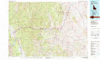
1982 Map of White Cloud Peaks
USGS Topo · Published 1982About this map
The Salmon River carves a deep path through Custer County on this 1982 survey, serving as the central artery for a landscape defined by its remote settlements and rich mining history. Along its banks and tributaries, you can find the riverside community of Clayton and the established stop at Robinson Bar. To the north, the historic mining district around Custer is detailed, featuring several notable operations such as the Sunbeam Mine and Lucky Boy Mine, which reflect the region's enduring mineral importance.
Find a feature on this map
70 named features on this map. Tap any name to fly to it.
Don’t see what you’re looking for? This feature index may not catch every label — zoom into the map to look around manually.
Map Details
Editions of this 1982 White Cloud Peaks Map
2 editions found
Other maps of this area

1891 · Bear Valley
USGS Topo · 1:125,000

1893 · Bear Valley
USGS Topo · 1:125,000

1894 · Rocky Bar
USGS Topo · 1:125,000

1895 · Hailey
USGS Topo · 1:125,000

1897 · Hailey
USGS Topo · 1:125,000

1900 · Sawtooth
USGS Topo · 1:125,000

1919 · Custer
USGS Topo · 1:125,000

1922 · Custer
USGS Topo · 1:125,000

1929 · Bayhorse
USGS Topo · 1:125,000

1930 · Casto
USGS Topo · 1:125,000