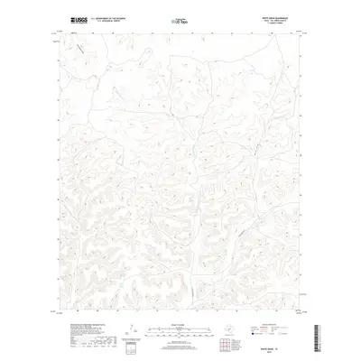
2019 Map of White Draw
USGS Topo · Published 2019About this map
Big Norris Spring and Little Norris Spring provide a rare glimpse into the hydrological network of this arid reach of Val Verde County. The terrain is deeply carved by a series of intermittent watercourses, including White Draw and Threemile Draw, which characterize the drainage patterns of the western Edwards Plateau. Transportation through this remote landscape is limited to Dolan Creek Rd, which follows the contours of the valley floors. The map meticulously traces the paths of Dolan Cr and its tributaries, such as Middle Dolan Cr and W Dolan Cr, illustrating how these drainages dictate the local topography. This 2019 survey captures the area in its contemporary state, showing the complex interplay between the occasional springs and the extensive draw systems that define the geography of the region.
Find a feature on this map
8 named features on this map. Tap any name to fly to it.
Don’t see what you’re looking for? This feature index may not catch every label — zoom into the map to look around manually.
Map Details
Editions of this 2019 White Draw Map
This is the sole edition of this map. No revisions or reprints were ever made.
Other maps of this area

1944 · Dry Devil
USGS Topo · 1:62,500

1944 · Baker Crossing
USGS Topo · 1:62,500

1954 · Sonora
USGS Topo · 1:250,000

1958 · Sonora
USGS Topo · 1:250,000

1958 · Del Rio
USGS Topo · 1:250,000

1964 · Del Rio
USGS Topo · 1:250,000

1970 · Juno
USGS Topo · 1:24,000

1970 · Deaton Draw
USGS Topo · 1:24,000

1973 · White Draw NW
USGS Topo · 1:24,000

1973 · Robinson Draw
USGS Topo · 1:24,000