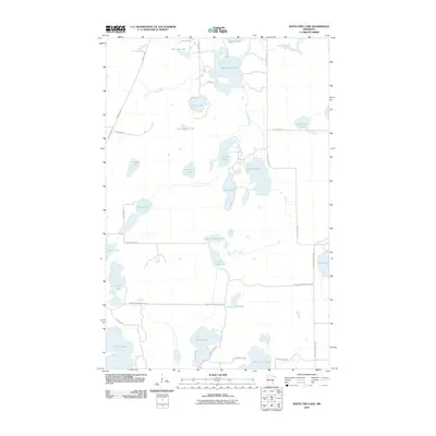
2010 Map of White Fish Lake
USGS Topo · Published 2010About this map
White Fish Lake and a dense network of glacial water bodies dominate this portion of Beltrami County, Minnesota. The landscape is defined by the hydrologic connections between Hay Creek, Darrigans Creek, and numerous named basins including Silver Lake, Jackson Lake, and Sandy Lake. Toward the southern edge of the survey, larger bodies like Turtle Lake, Black Lake, and Three Island Lake are reached via a grid of secondary roads such as Buena Vista Forest Rd NE and Tower Rd NE. This 2010 snapshot reflects the modern configuration of the Northern Minnesota lake country, showing established access routes like County Hwy 15 and County Hwy 203 alongside specialized roads like Gull Lake Loop Rd NE. The map provides a precise record of water levels and shoreline features, such as Hidden Bay and Long Slough Lake, essential for understanding the seasonal and ecological character of this timbered lake region.
Find a feature on this map
39 named features on this map. Tap any name to fly to it.
Don’t see what you’re looking for? This feature index may not catch every label — zoom into the map to look around manually.
Map Details
Editions of this 2010 White Fish Lake Map
This is the sole edition of this map. No revisions or reprints were ever made.
Other maps of this area

1919 · Quiring
USGS Topo · 1:62,500

1920 · Buena Vista
USGS Topo · 1:62,500

1954 · Bemidji
USGS Topo · 1:250,000

1957 · Bemidji
USGS Topo · 1:250,000

1958 · Bemidji
USGS Topo · 1:250,000

1972 · Peterson Lake
USGS Topo · 1:24,000

1972 · Turtle River Lake
USGS Topo · 1:24,000

1972 · Redby
USGS Topo · 1:24,000

1972 · White Fish Lake
USGS Topo · 1:24,000
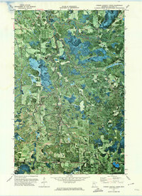
1972 · O'Brien Lookout Tower
USGS Topo · 1:24,000