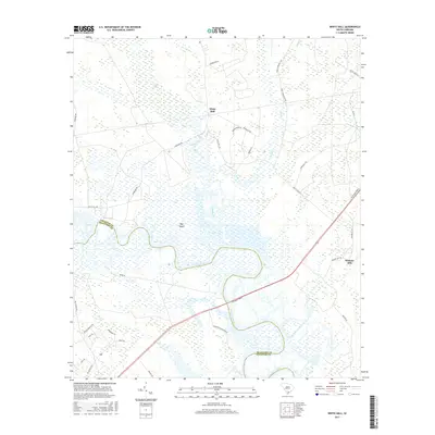
2017 Map of White Hall
USGS Topo · Published 2017About this map
The Combahee River defines the low-lying geography of this coastal South Carolina landscape, winding through a complex of wetlands including Calfpen Swamp and Bay Island. This 2017 study illustrates the rural character of the border between Colleton County and Beaufort County, where agriculture and conservation interests meet. Small settlements like White Hall and Hickory Hill anchor the local road network, which includes family-named routes and descriptive historical lanes like African Baptist Rd and Nemours Plantation Dr.
Find a feature on this map
32 named features on this map. Tap any name to fly to it.
Don’t see what you’re looking for? This feature index may not catch every label — zoom into the map to look around manually.
Map Details
Editions of this 2017 White Hall Map
This is the sole edition of this map. No revisions or reprints were ever made.
Other maps of this area

1918 · Walterboro
USGS Topo · 1:62,500

1918 · Green Pond
USGS Topo · 1:62,500

1918 · Yemassee
USGS Topo · 1:62,500

1919 · Cummings
USGS Topo · 1:62,500

1943 · Yemassee
USGS Topo · 1:62,500

1943 · Green Pond
USGS Topo · 1:62,500

1943 · Cummings
USGS Topo · 1:62,500

1943 · Walterboro
USGS Topo · 1:62,500

1947 · Savannah
USGS Topo · 1:250,000

1948 · Savannah
USGS Topo · 1:250,000