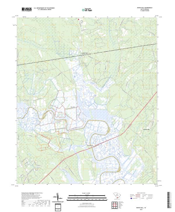
2024 Map of White Hall
USGS Topo · Published 2024About this map
The Combahee River defines the landscape of this Lowcountry region, weaving through the expansive protected marshes of the Ernest F Hollings Ace Basin National Wildlife Refuge. This environment is characterized by a complex network of tidal waterways and wetlands, including Cuckolds Creek, Folly Creek, and the dense Calfpen Swamp. The intersection of nature and human transit is evident at the Combahee Ferry crossing, a historic point on the river that now sits alongside the modern Ace Basin Pkwy.
Find a feature on this map
37 named features on this map. Tap any name to fly to it.
Don’t see what you’re looking for? This feature index may not catch every label — zoom into the map to look around manually.
Map Details
Editions of this 2024 White Hall Map
This is the sole edition of this map. No revisions or reprints were ever made.
Other maps of this area

1918 · Walterboro
USGS Topo · 1:62,500

1918 · Green Pond
USGS Topo · 1:62,500

1918 · Yemassee
USGS Topo · 1:62,500

1919 · Cummings
USGS Topo · 1:62,500

1943 · Yemassee
USGS Topo · 1:62,500

1943 · Green Pond
USGS Topo · 1:62,500

1943 · Cummings
USGS Topo · 1:62,500

1943 · Walterboro
USGS Topo · 1:62,500

1947 · Savannah
USGS Topo · 1:250,000

1948 · Savannah
USGS Topo · 1:250,000