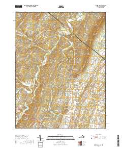
2019 Map of White Hall
USGS Topo · Published 2019About this map
North Mtn and Little North Mountain define the prominent ridgelines along the border of Frederick County, Virginia, and Berkeley County, West Virginia, in this 2019 survey. The area transitions from the elevated forests of the Tuscarora Trail down to the fertile agricultural lands of Apple Pie Ridge. Small residential settlements and historic centers such as White Hall, Green Spring, and De Haven are scattered across the landscape, connected by rural routes that follow the natural topography of the Great North Mountain foothills.
Find a feature on this map
150 named features on this map. Tap any name to fly to it.
Don’t see what you’re looking for? This feature index may not catch every label — zoom into the map to look around manually.
Map Details
Editions of this 2019 White Hall Map
This is the sole edition of this map. No revisions or reprints were ever made.
Other maps of this area

1894 · Winchester
USGS Topo · 1:125,000

1914 · Gerrardstown
USGS Topo · 1:48,000

1916 · Gerrardstown
USGS Topo · 1:62,500

1916 · Capon Bridge
USGS Topo · 1:62,500

1923 · Middletown
USGS Topo · 1:62,500

1923 · Capon Bridge
USGS Topo · 1:62,500

1937 · Capon Bridge
USGS Topo · 1:48,000

1937 · Gerrardstown
USGS Topo · 1:48,000

1937 · Middletown
USGS Topo · 1:48,000

1938 · Winchester
USGS Topo · 1:48,000