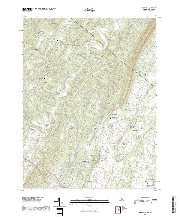
2022 Map of White Hall
USGS Topo · Published 2022About this map
Little North Mountain and North Mountain dominate this corner of Frederick County, where the Virginia and West Virginia state line cuts through the ridge at Dutton Gap. The landscape is defined by long, narrow valleys like Warm Springs Hollow and Frog Hollow, which historically channeled settlement and transportation along the base of these prominent heights. Small communities such as White Hall, De Haven, and Cedar Grove are clustered along these corridors, often centered around long-standing religious institutions like the Pine Grove United Methodist Church or the Pleasant Valley United Methodist Church. The map reveals a dense concentration of local heritage sites, particularly cemeteries like the Old Stone Church Cem and Chestnut Grove Cem, which serve as vital markers for genealogical research. The drainage patterns of Back Creek and its tributaries, including Babbs Run and Cattail Run, have shaped the agricultural layout of the area, notably along the fertile Apple Pie Ridge.
Find a feature on this map
162 named features on this map. Tap any name to fly to it.
Don’t see what you’re looking for? This feature index may not catch every label — zoom into the map to look around manually.
Map Details
Editions of this 2022 White Hall Map
This is the sole edition of this map. No revisions or reprints were ever made.
Other maps of this area

1894 · Winchester
USGS Topo · 1:125,000

1914 · Gerrardstown
USGS Topo · 1:48,000

1916 · Gerrardstown
USGS Topo · 1:62,500

1916 · Capon Bridge
USGS Topo · 1:62,500

1923 · Middletown
USGS Topo · 1:62,500

1923 · Capon Bridge
USGS Topo · 1:62,500

1937 · Capon Bridge
USGS Topo · 1:48,000

1937 · Gerrardstown
USGS Topo · 1:48,000

1937 · Middletown
USGS Topo · 1:48,000

1938 · Winchester
USGS Topo · 1:48,000