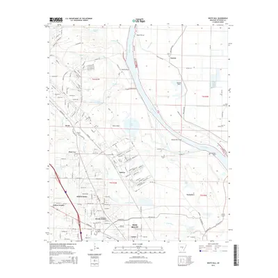
2014 Map of White Hall
USGS Topo · Published 2014About this map
Arkansas River navigation and the growing suburban reach of Pine Bluff define this 2014 geographic study. The river corridor is shaped by prominent landforms like Tripletts Bluff and Yellow Bluff, along with significant engineering features such as the Hensley Bar Cutoff. In the surrounding lowlands, numerous oxbows and water bodies including Yellow Lake, Dilly Pond, and Lake Lee reflect the changing course of the waterway over time.
Find a feature on this map
179 named features on this map. Tap any name to fly to it.
Don’t see what you’re looking for? This feature index may not catch every label — zoom into the map to look around manually.
Map Details
Editions of this 2014 White Hall Map
This is the sole edition of this map. No revisions or reprints were ever made.
Other maps of this area

1932 · Pastoria
USGS Topo · 1:62,500

1935 · Altheimer
USGS Topo · 1:62,500

1935 · Pastoria
USGS Topo · 1:62,500

1935 · Noble Lake
USGS Topo · 1:62,500

1948 · Helena
USGS Topo · 1:250,000

1950 · Helena
USGS Topo · 1:250,000

1955 · Helena
USGS Topo · 1:250,000

1955 · Little Rock
USGS Topo · 1:250,000

1956 · Little Rock
USGS Topo · 1:250,000

1959 · Helena
USGS Topo · 1:250,000