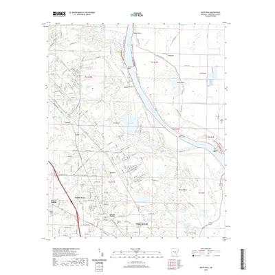
2020 Map of White Hall
USGS Topo · Published 2020About this map
The Arkansas River carves a dominant path through this Jefferson County landscape, shaping the local geography with distinctive features like Tripletts Bluff and the oxbow curves of Pastoria Bend. Centered on the growing community of White Hall, the area is characterized by residential expansion into Oakland Heights and Henslee Heights, bordering the industrial and municipal edges of Pine Bluff. Genealogists will find significant value in the documentation of local burial grounds, including Cheek Cem, Musgrove Cem, and McFadden Cem, which anchor the smaller historical settlements of Pastoria and Baldwin. The complex network of waterways, from Eastwood Bayou to Caney Bayou, illustrates the alluvial nature of the terrain between the upland developments and the river's Hensley Bar Cutoff.
Find a feature on this map
167 named features on this map. Tap any name to fly to it.
Don’t see what you’re looking for? This feature index may not catch every label — zoom into the map to look around manually.
Map Details
Editions of this 2020 White Hall Map
This is the sole edition of this map. No revisions or reprints were ever made.
Other maps of this area

1932 · Pastoria
USGS Topo · 1:62,500

1935 · Altheimer
USGS Topo · 1:62,500

1935 · Pastoria
USGS Topo · 1:62,500

1935 · Noble Lake
USGS Topo · 1:62,500

1948 · Helena
USGS Topo · 1:250,000

1950 · Helena
USGS Topo · 1:250,000

1955 · Helena
USGS Topo · 1:250,000

1955 · Little Rock
USGS Topo · 1:250,000

1956 · Little Rock
USGS Topo · 1:250,000

1959 · Helena
USGS Topo · 1:250,000