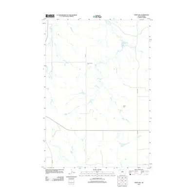
2012 Map of White Hill
USGS Topo · Published 2012About this map
White Hill rises as a primary landmark in this corner of Harding County, anchoring a high plains landscape defined by its drainage systems and ranch-to-market roads. The topography is shaped by the winding course of White Hill Cr, which is intercepted by the White Hill Dam in the northeastern quadrant. This 2012 survey illustrates the modern grid of the South Dakota prairie, where long-established routes like Sorum Rd and White Hill Rd intersect at wide intervals. For genealogists, the map provides a specific point of interest at the Henry Bingaman Cem, located along 155th Ave. This small cemetery serves as a rare structural marker in a territory otherwise dominated by natural features and isolated sections of the township and range system.
Find a feature on this map
9 named features on this map. Tap any name to fly to it.
Don’t see what you’re looking for? This feature index may not catch every label — zoom into the map to look around manually.
Map Details
Editions of this 2012 White Hill Map
This is the sole edition of this map. No revisions or reprints were ever made.
Other maps of this area

1935 · Reva
USGS Topo · 1:125,000

1935 · Hoover
USGS Topo · 1:125,000

1954 · Lemmon
USGS Topo · 1:250,000

1957 · Lemmon
USGS Topo · 1:250,000

1968 · Reva
USGS Topo · 1:24,000

1968 · Flat Top Butte
USGS Topo · 1:24,000

1969 · Reva NE
USGS Topo · 1:24,000

1980 · Redig
USGS Topo · 1:100,000

1980 · Camp Crook
USGS Topo · 1:100,000

1983 · Prairie City NE
USGS Topo · 1:24,000